iTools App icon

iTools app
POCKET MULTI TOOL
COMPASS | COORDINATES | SEISMOMETER

appstore badge

Learn More

iTools what?

A little story with huge impact

iTools started as a purely safety app, where in case of extreme emergency it will give you vital information to be alive and well. Is a live earthquakes monitor, thus can save you crucial seconds - especially when sleeping - to act as planned. Coordinates is a system where is totally independent of address, so you can send your coordinates to 911, 112 or any other emergency agency and pinpoint the exact location of you to come and save you. Light tools can shed light exactly where you see fit to, and compass to help you manually navigate.

Over the years, iTools is being used by ambulances, hitchhikers, boat enthusiasts, private airplanes, in car, and many many people who have the need to send a location to someone that does not have an address. Like a park bench, a certain building point, a house within a huge block with one entrance, a shop in a huge parking lot, any place where address is useless. And also save it as a contact.

In a nutshell, iTools have contributed in saving 3 human lives, where in all cases it was difficult for the ambulance to pinpoint the emergency site. People who were at the site used iTools to send the exact location with coordinates to the ambulance.

Really proud for iTools.

Features

A Navigation & Emergency Multi Tool, always in your pocket,
suitable for everyone in move!

MAP OVERLAY

Along with crucial info, 2D or 3D map with heading. More info

SEISMOMETER

Earthquake live monitor & alarm. More info

COMPASS

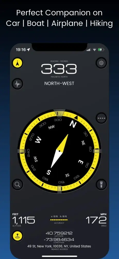
Big Multi-color compass with Heading and Degrees - works with the built-in magnetometer or movement (if magnetometer is not available) - a fail safe feature.

SHARE LOCATION

Send your coordinates with address. Message & email. More info
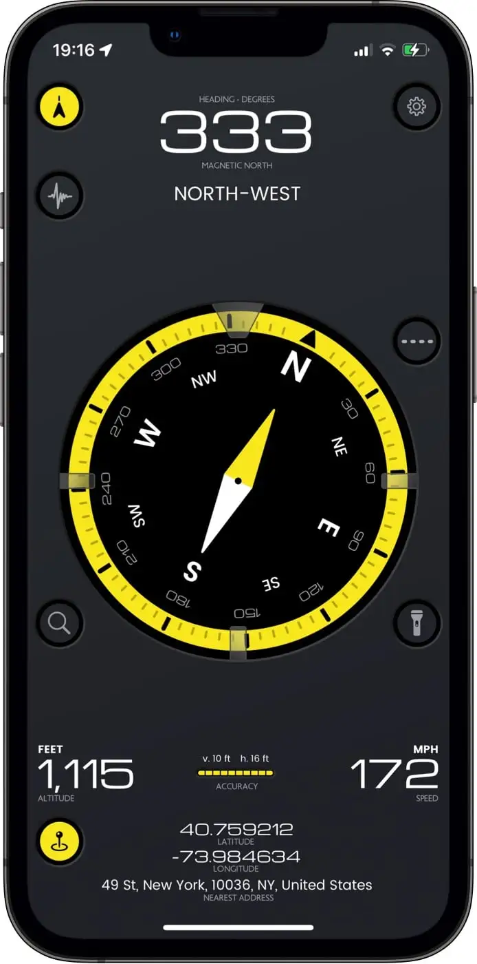
Feature ImageMeasurements during a private flight

SETTINGS

Personalize your experience.
More info

ALTITUDE - SPEED

Cycle through various units and see your altitude & speed with maximum accuracy. Works best when outdoors.

LIGHT TOOLS

Flashlight with camera for tight corners, flashlight & sos flashlight.

LOCATION INFO

Current address & coordinates display. Know exactly where you are.

LOCATION ACCURACY

Is your location accurate enough for you? See it in a glance.

MAP OVERLAY

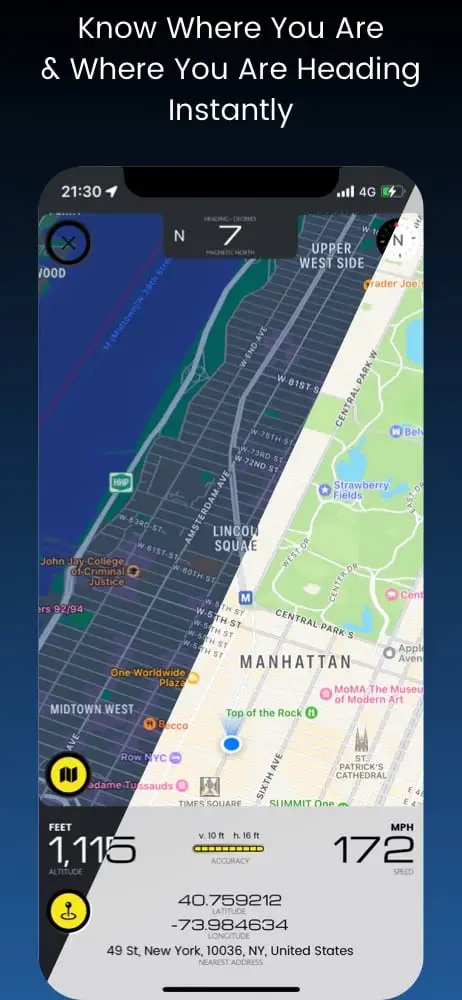
Visualize your heading by displaying it on the map and see what is ahead, while having all the essential info about your location.

HEADING

Your heading degrees right in front for your convenience.

3D VIEW

Slide two fingers to the top to see the 3D map overlay.

SATELLITE VIEW

Toggle between standard map view or satellite view.

SHARE LOCATION

Send your coordinates with address. Message & email. More info
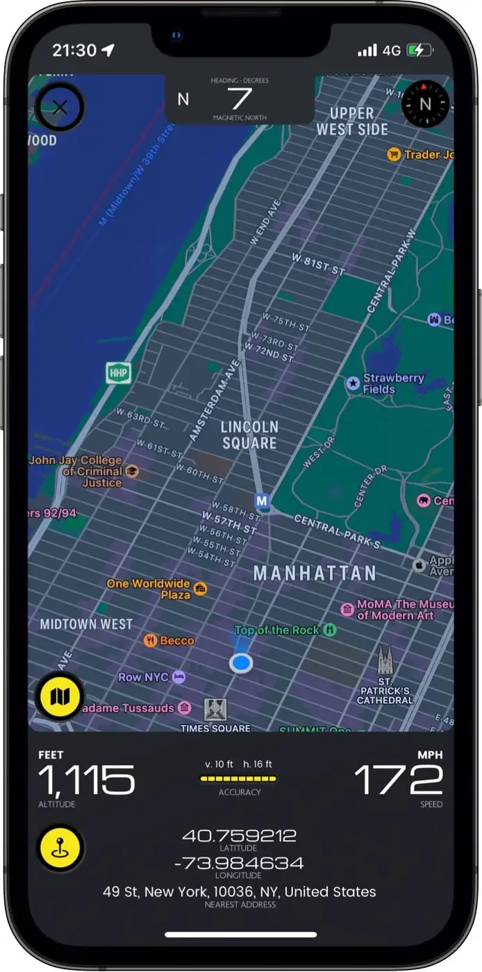
Feature ImageMap overlay during a private flight

ALTITUDE - SPEED

Cycle through various units and see your altitude & speed with maximum accuracy. Works best when outdoors.

LOCATION ACCURACY

Is your location accurate enough for you? See it in a glance.

LOCATION INFO

Current address & coordinates display. Know exactly where you are.

SHARE LOCATION

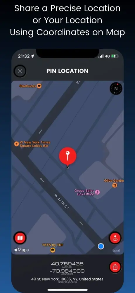
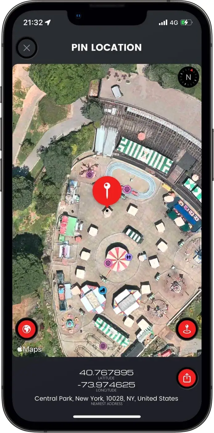
Share an extra precise location or your current location
by using coordinates on map.
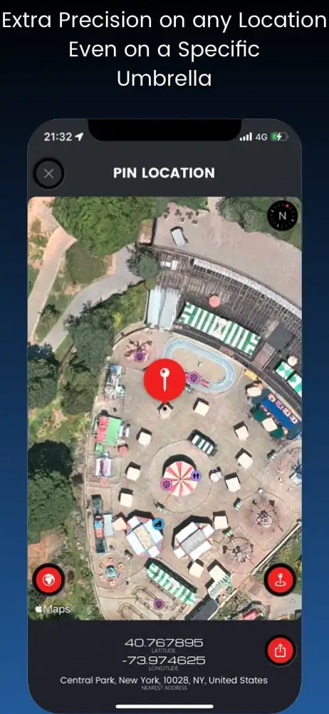
Extra precision means an umbrella on a park or a car park slot!

LOCATION PRECISION

Pinpoint anything on the map or your location by using coordinates.

SATELLITE or MAP VIEW

Toggle between standard map view or satellite view.

LOCATION or PIN INFO

Current address & coordinates display. Know exactly where you are or your pin is.

COMPATIBILITY

Sending map links can be a pain. Not here. Links are compatible with any smart device.
Feature ImageOur meeting point under that umbrella in the heart of New York

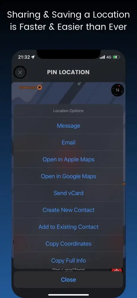
MESSAGE LOCATION

Easy iMessage or SMS with all location info

EMAIL LOCATION

Send an email with Coordinates, Address, Map links and Map screenshot.

SAVE LOCATION

Save a precise location to an existing contact or a new one. Then you can tell Siri to drive you there.

ATTACH vCARD

Send a vCard (a contact's file), containing precise location information.

Seismometer

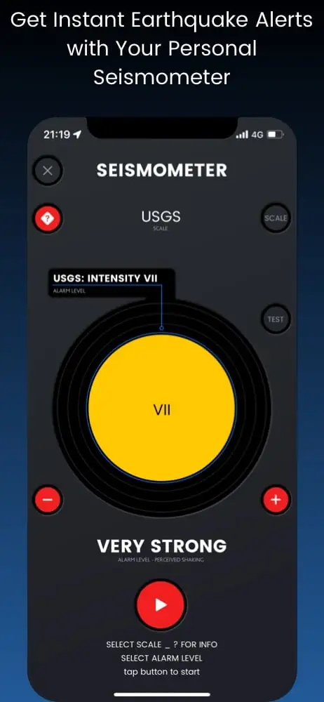
You afraid if an earthquake will occur? Have this function by your side and be alarmed instantly. An extra tool for your safety.

PROTECTION

Seismometer will alert you of an earthquake as you can feel it exactly where you are.

LIFESAVER

While at sleep? Will wake you up and save crucial seconds of action. A true lifesaver.

ALGORITHM

A special designed algorithm senses the motion of the device and converts it into earthquake scales.

DESIGN

Continually improving design, to make it easier and handier.
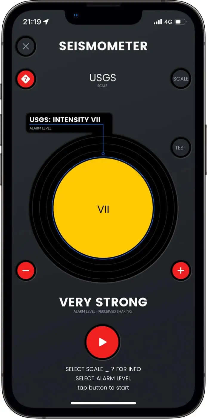
Telegram Image* Used by various academic institutions for demo purposes

EARTHQUAKE SCALES

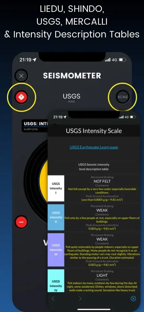
Cycle through the 4 major earthquake scale: USGS (USA), Shindo (Japan), Liedu (China), Mercalli (World).

HELP ON SCALES

Every scale has its shaking table. Please advise it before choosing an intensity level.

INTENSITY LEVELS

Set the level of perceived shaking (alarm) every scale has to offer.

ALARM

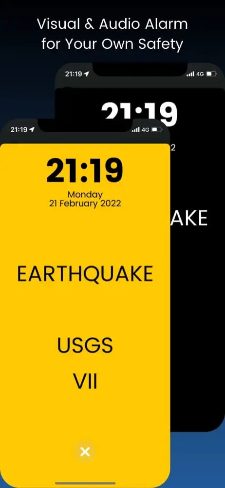
Instant alarm with audio & visual feedback. Press TEST button to see what happens.

ScreenShots

Settings

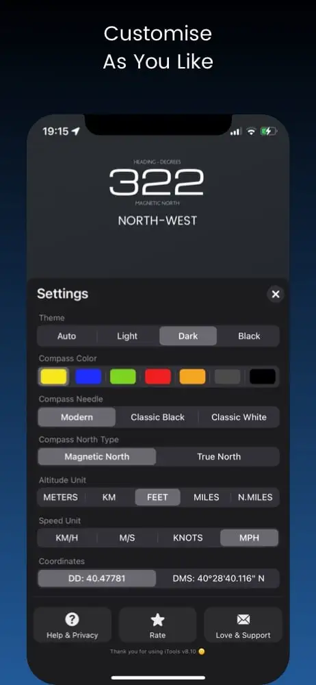
COLORS

Personalization starts with color. Choose one to start with.

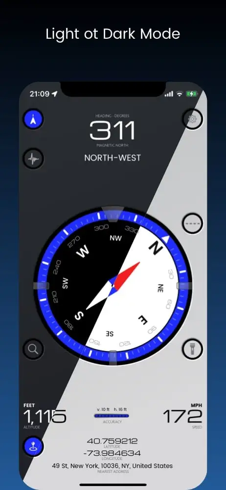
DARK OR LIGHT?

Can be both ways to make it more comfortable under various light conditions.

COORDINATES

Choose what suits you best. DD or DMS. More to come in future updates.

ALTITUDE UNITS

Meters, Kilometers, Feet, Miles, Nautical Miles. All are here.
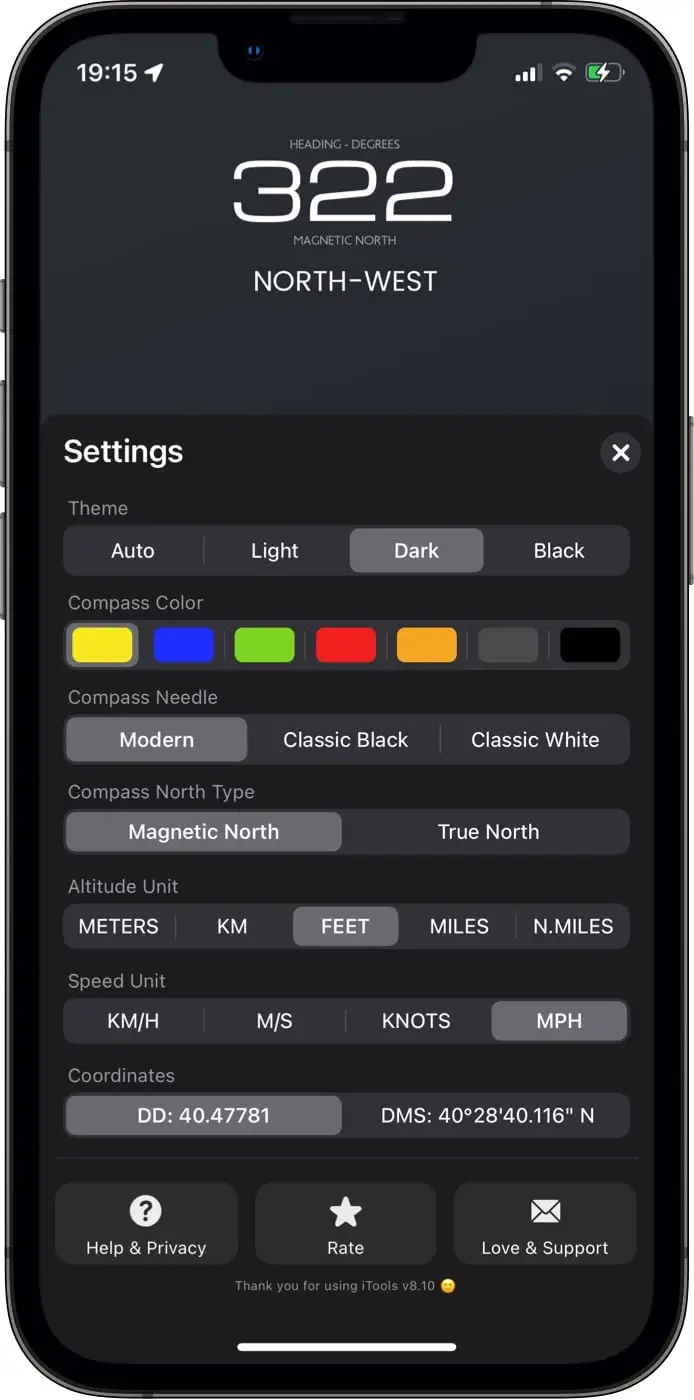
Settings Image* Thank You for Using iTools 😀

SPEED UNITS

Choose what suits you best.

NORTH TYPE

Magnetic or True? You know, magnetic north is changing.

HELP

Here you can find anything about iTools.

SUPPORT

If FAQ is not enough, we got you covered. Send in your message directly to Support and soon you will get a response.

FAQ

This section is specially curated to fully understand iTools app.
If you still have a question contact us via iTools' Settings.
A Navigation & Emergency Multitool Always in Pocket
Everyone in move, by Car, Airplane or Boat
  • It gives you detailed and important location information,
  • Can share an exact location everywhere by using coordinates,
  • Can alarm and save crucial seconds when an earthquake occurs - especially during sleeping
  • iTools gives you all the navigation information you need in a beautiful and intuitive way,
  • iTools has optimized code to consume as little battery as possible,
  • iTools gives you Seismometer, a super safety tool if you are afraid earthquakes
Map overlay helps you visualize what is ahead of you as you keep moving.
Map overlay helps you visualize what is ahead of you as you keep moving. Especially handy in a private airplane or a boat, but also handy in a car. Can not guide you, but you will see what is ahead of you.
Slide two fingers to the top to adjust 3D view angle.
  • Press bottom left button with Pin to show Share Location view.
  • Press bottom right button to show you sending options.
In Share Location view, drag map to choose the location. Then press bottom right button containing sending options.
Coordinates is a navigation system that is used by professionals to accurate pinpoint any location on earth.
Coordinates are the most accurate location system that exists today.
It is a contact file containing all contact's info like names, phones, addresses and more.
While in Share Location view (bottom left icon with Pin)
  • Choose location (drag map or your current position,
  • Press bottom right button with options,
  • Select "Create New Contact",
  • Enter Name Surname,
  • Enter Location Title (eg Home, Work, Fishing point),
  • Press "Create"
  • A Saved confirmation message will be displayed
Now you can find the newly added contact into your phone's contacts
While in Share Location view (bottom left icon with Pin)
  • Choose location (drag map or your current position,
  • Press bottom right button with options,
  • Select "Add to Existing Contact",
  • Allow iTools to access contacts (also in system's settings)
  • Choose Contact,
  • Enter Location Title (eg Home, Work, Fishing point),
  • Press "Add"
  • A Saved confirmation message will be displayed
Now you can find the newly added location into the previously selected contact
You must allow access to contacts
Map links are compatible with every device that has an internet browser and dedicated map apps.
Unfortunately you can not. It is prohibited by Apple for security and privacy reasons. If any change occur, this function will be available.
Seismometer is a scientific equipment that can measure earthquakes. Their intensity of movement or magnitude.
Seismometer app is designed to measure intensity of movement by using device's integrated accelerometer and gyroscope.

A special algorithm translates movement into the 4 widely used earthquake scales.
A special designed algorithm translates movement into the 4 widely used earthquake scales. USGS, Shindo, Liedu and Mercalli.
As a safety feature that can be handy in a place with a lot of earthquakes. First an earthquake occurs and then you can hear it in the news or websites.
First press the second top left button in the main view
  • Select Scale
  • Press "?" button to read about the specific scale and its levels of intensity
  • Press "Test" to see and hear the alarm
  • Adjust your desired alarm level of intensity by using "+" & "-" buttons
  • It is recommended - but not obligatory - to enable airplane mode and disable wifi and bluetooth
  • Leave device on a steady surface like the floor
  • Press Play button to start
Do not use or touch your device as you will trigger the alarm
Of course it can! Can give you crucial seconds of action between the event of an earthquake and the realization of an earthquake. Experts say that 3-5 seconds of action can be the difference between life and death when a vast earthquake occurs.
Are earthquake intensity scales used by major institutes to monitor the movement and the results of an earthquake, used in various parts of the globe.
Richter scale represents earthquake's magnitude and it can not be measured by using accelerometer and gyroscope. Needs very specific equipment and expensive one. Also magnitude represents the power of an earthquake and it is crucial for scientific purposes only.

Intensity movement scales are human oriented and easier to understand and use.
Yes. Any movement of the device will be translated into an earthquake intensity movement and will trigger a false alarm.
No. Any movement of the device will be translated into an earthquake intensity movement and will trigger a false alarm.
Be aware that leaving a device with display on, will consume too much battery in little time. An iPhone 12 Pro will take approximately 8 hours to be empty.
It is recommended but not obligatory.

iPhones & iPads are the safest devices you can use, but there are rare cases where some equipment always connected to chargers malfunctioned. Especially iPads can be used as kiosks - meaning always connected to power. In any case use your equipment at your own risk as iTools app can not be responsible for any battery or device malfunction.
Yes. Be aware that leaving a device with display on, will consume too much battery in little time. An iPhone 12 Pro will take approximately 8 hours to be empty.
Your floor is the best place (be careful not to step on it). Also a heavy furniture with no moving surface like a heavy table.
No, not at the moment
Yes you need in order to get map functions, location address and to share your or any location with others.
Yes, and you will have functions working like compass, coordinates, altitude and speed. In an airplane you do not need internet connection, but be aware that wifi & bluetooth needs to be on, and in some cases cellular reception (not 4-5G) needs to be on to accurately show altitude and speed. Use it at your own risk as iTools will not be responsible for any airplane or other machinery equipment malfunction.
Yes you can. But be aware that leaving a device with display on, will consume too much battery in little time. An iPhone 12 Pro will take approximately 8 hours to be empty.
iPhones & iPads are the safest devices you can use, but there are rare cases where some equipment always connected to chargers malfunctioned. Especially iPads can be used as kiosks - meaning always connected to power. In any case use your equipment at your own risk as iTools app can not be responsible for any battery or device malfunction.
There are cases that have been reported that original equipment did malfunction. But those are really rare. Use your equipment at your own risk and test it before operation.
In Settings at the bottom right corner, press ‘Love & Support’ to send in your email. Please do so!
No. At least not at this moment.
  • Unique Outstanding Design App!
    ⭐️⭐️⭐️⭐️⭐️

    I would like to sit down from my walk through the Woods in my area and catch my breath! This for myself is a great unique system 5 Star app that helps me as a very ole man to not get lost! Oh the Developer put a great deal of time hard work sweat and love into the coding of this software! This unique app is useful in so many ways ( right now for me not to get lost in these Woods ) , but if you Download this app now today at this moment it will Help you and your family! ( Really ) with Technology changing every day every second every minute you can tell the Developer keeps up with the coding of His software by the number of updates that is being made! Well it’s that Time for this ole Man to get up and get going! So with that I want to Thank the Developer for putting out a Great Unique 5 Star Design App for this ole man! So Mr Developer I Tip my Hat to you and say Thanks! 🎩
    by RLNfirst
  • Amazing!
    ⭐️⭐️⭐️⭐️⭐️

    This app helped me find my way.i like it
    by jaswi124
  • Πολυεφαρμογή
    Multitool
    ⭐️⭐️⭐️⭐️⭐️

    Πολύ καλή εφαρμογή και χρήσιμη.Εύκολη στη χρήση!
    Very good and useful app. Easy on operation
    by Μάνθος M

Download now

iTools app will make your life easier.

appstore badge